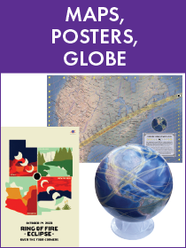
Eclipse Maps and Posters
All sales are final
No returns or refunds
Ring of Fire Eclipse over the Western USA - October 14, 2023
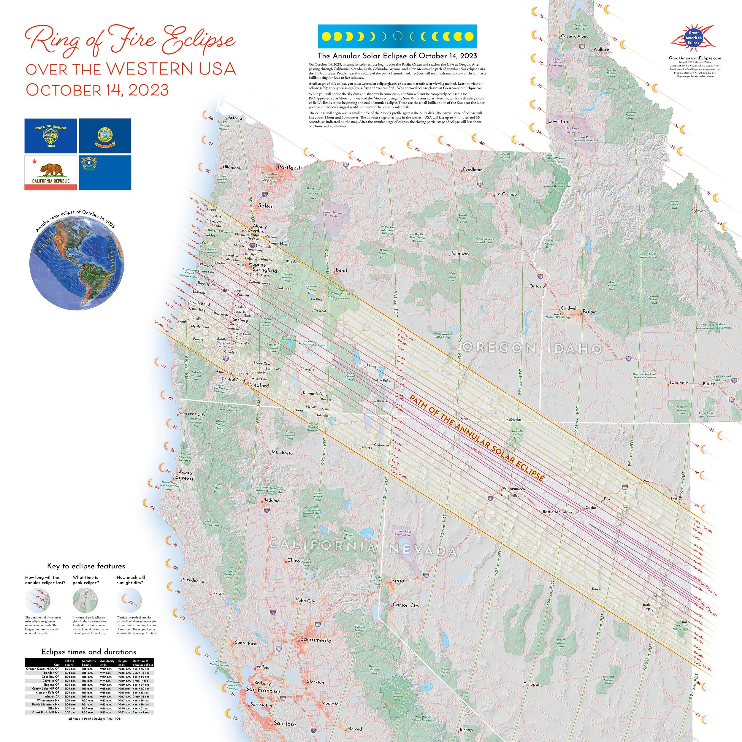
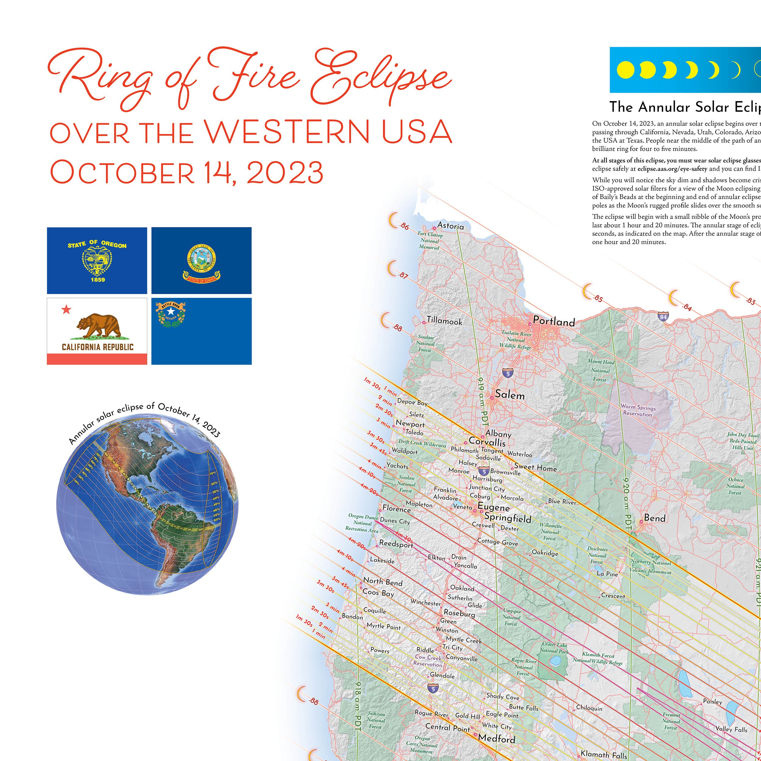
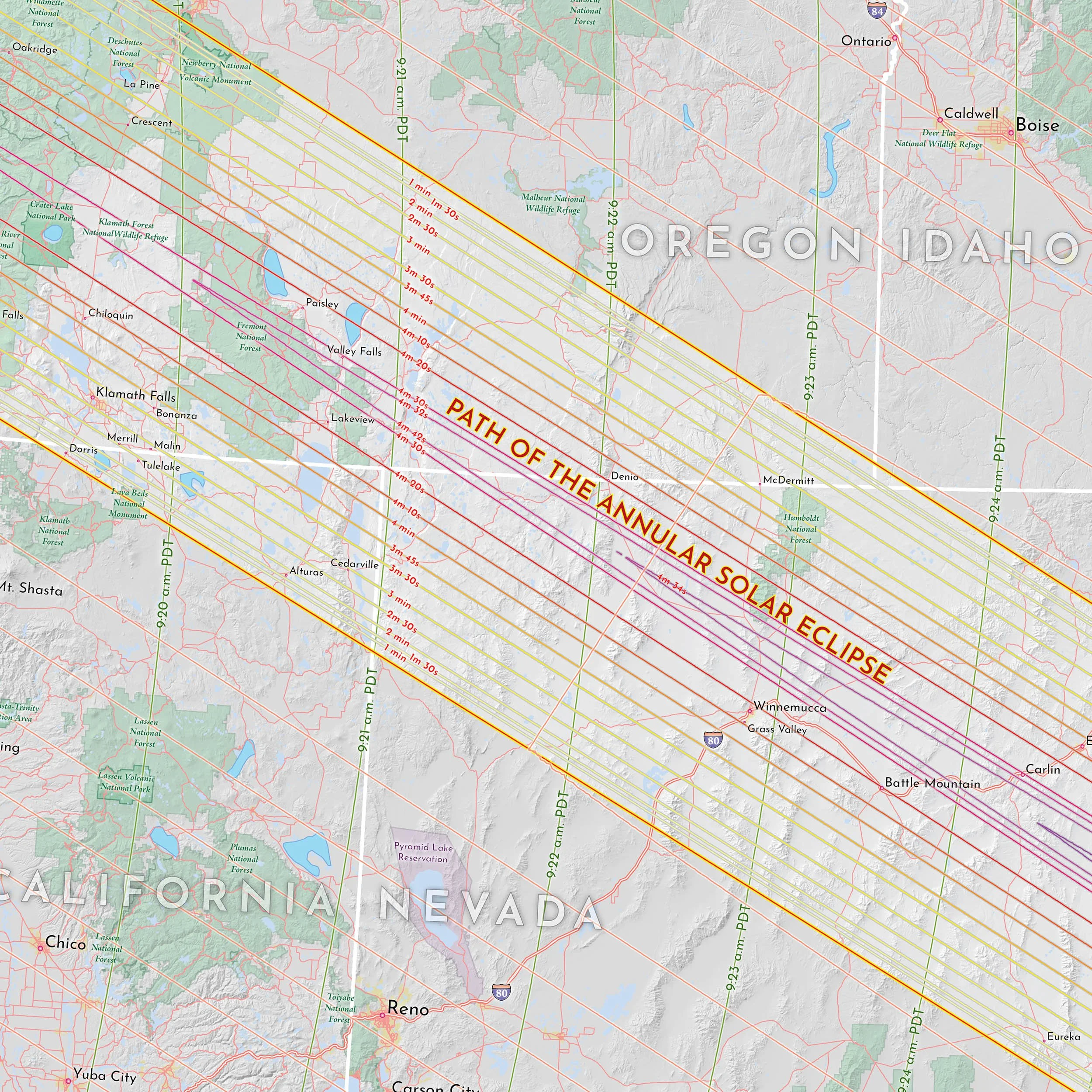
Ring of Fire Eclipse over the Western USA - October 14, 2023
27” x 27” printed on glossy poster cardstock. Rolled and shipped in a tube.
This beautiful and informative map displays the passage of the annular solar eclipse across California, Nevada, Oregon, and a corner of Idaho. This map is your guide to picking an optimum site for eclipse day and an invitation to explore the American west. This is the perfect planning guide for your eclipse trip and also lets you explore alternative sites shortly before eclipse day in case of weather.
Starting at 9:18 am PDT, persons inside the path of annular solar eclipse have the opportunity to see the rare vision of the Sun as a ring.
This map shows these prime areas for eclipse viewing:
- The Oregon beach communities that are well situated for the eclipse
- The length of the I-5 corridor from Medford to Corvallis wholly inside the path of annular eclipse
- Crater Lake National Park, Lava Beds National Monument, Great Basin National Park
- Several Nevada cities along I-80 inside the path
This map also gives the following information about the eclipse:
- How long the annular solar eclipse will last
- The time of peak eclipse inside and outside the path of annular solar eclipse
- How much sunlight will dim at maximum eclipse outside the path
- A table of eclipse times and durations for cities inside the path
The path of the eclipse has been precisely computed and the map shows exactly where the annular solar eclipse can be seen along with the eclipse durations. The times of eclipse are given in Pacific Daylight Time.