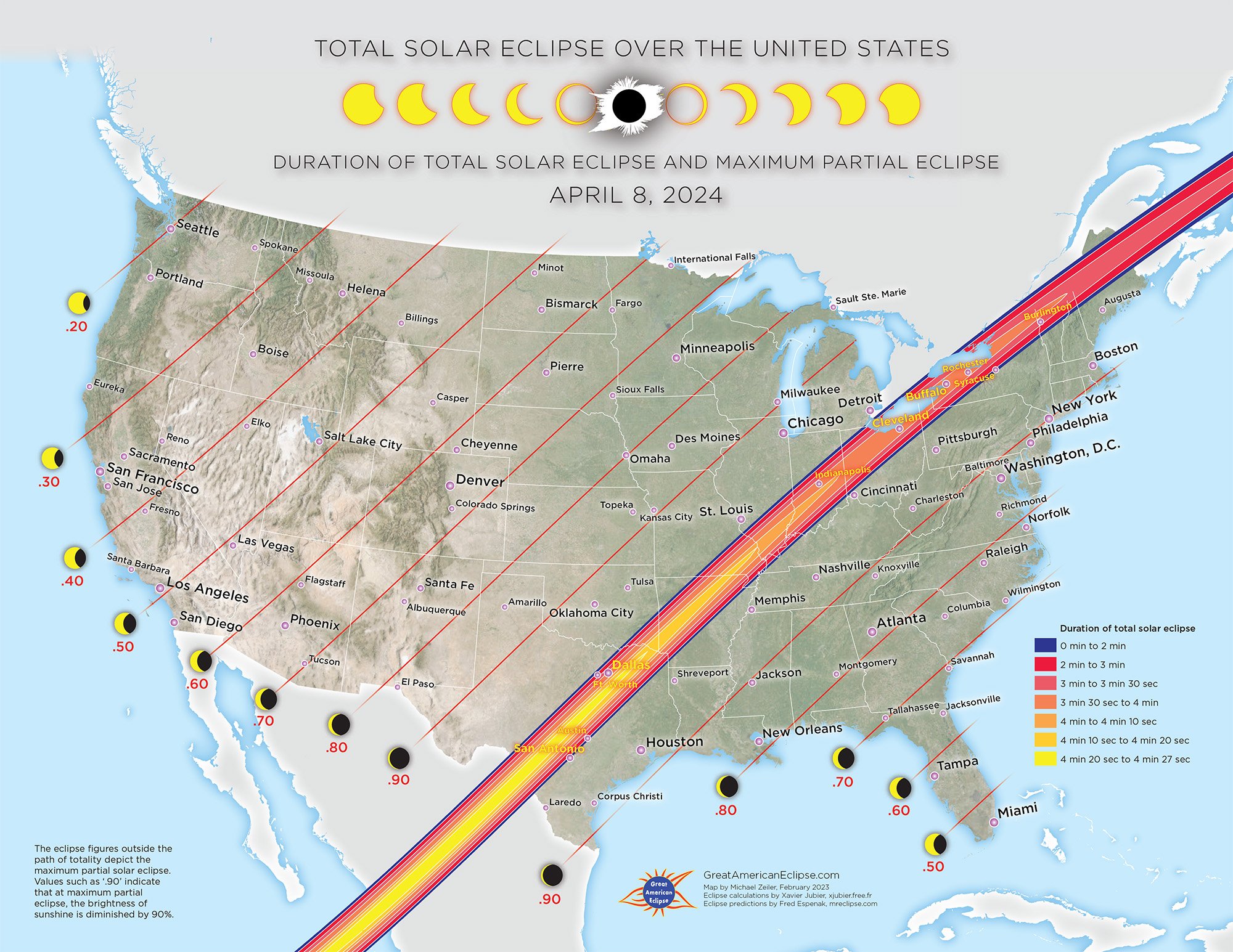
Total Solar Eclipse over the United States on April 8, 2024

Photo of 2017 total solar eclipse by Michael Zeiler
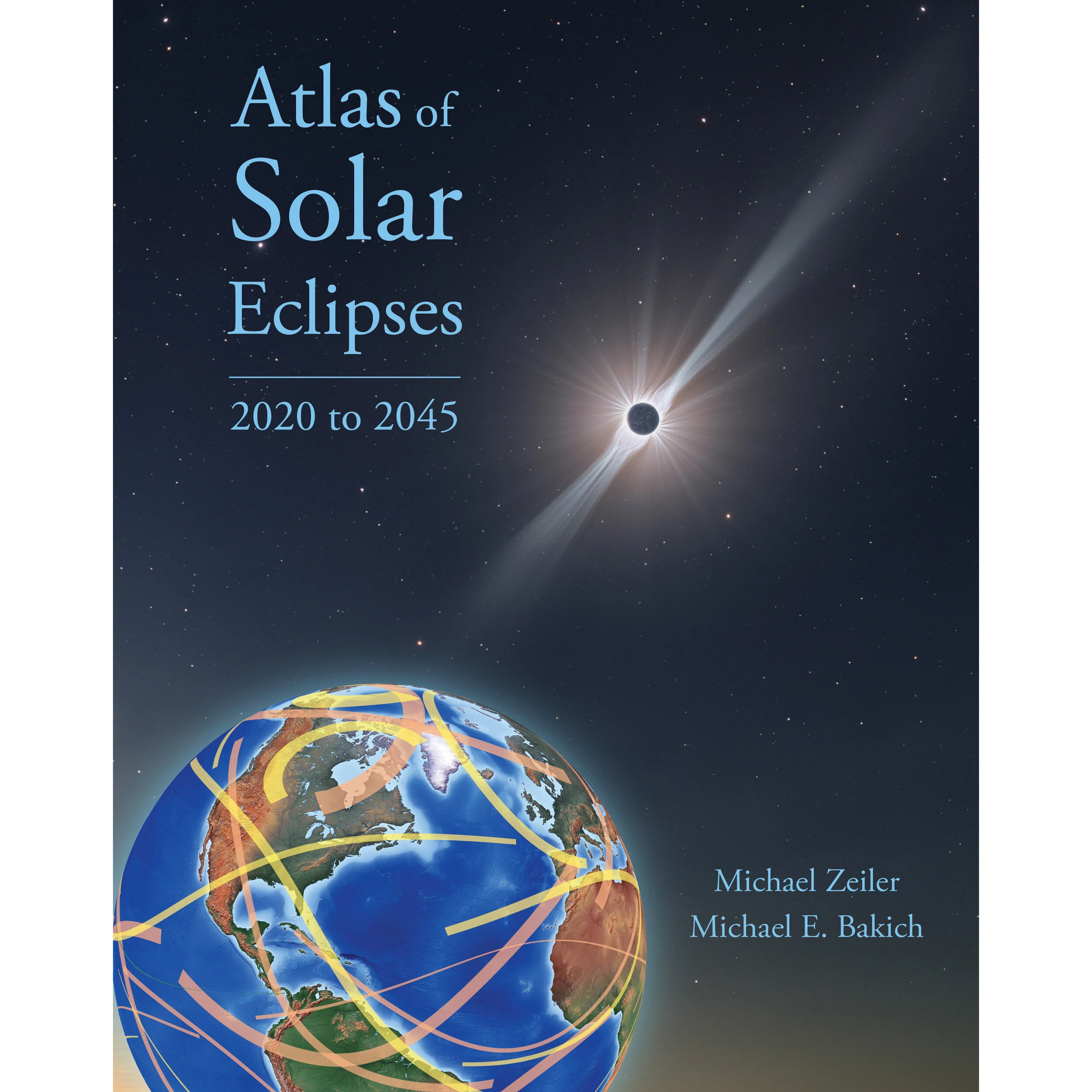
After a nearly 7-year interval from the Great American Eclipse of August 21, 2017, a total solar eclipse returns to the United States! We encourage everyone to get inside the path of totality, which, in the US, goes from Texas to Maine. The dramatic sight of the Sun’s corona in the suddenly darkened sky is a spectacular experience, and worth every effort.
The five maps in the slideshow below feature the total solar eclipse over the United States and answer your basic questions.
How long will the total solar eclipse be? If I am outside the path of totality, what is the maximum partial solar eclipse I can expect to see?
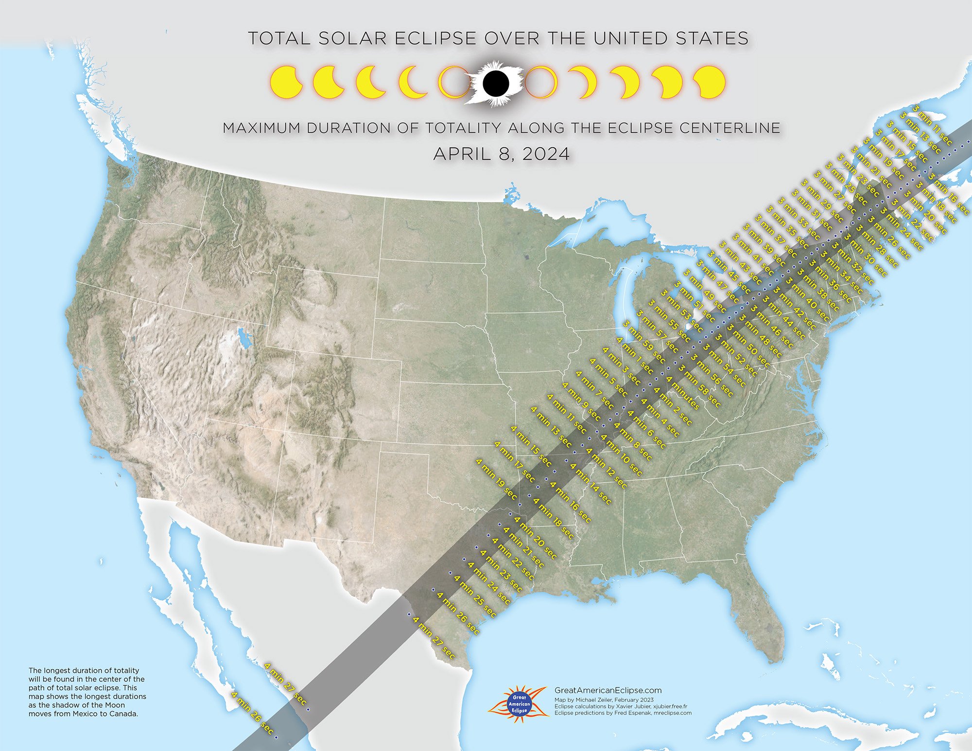
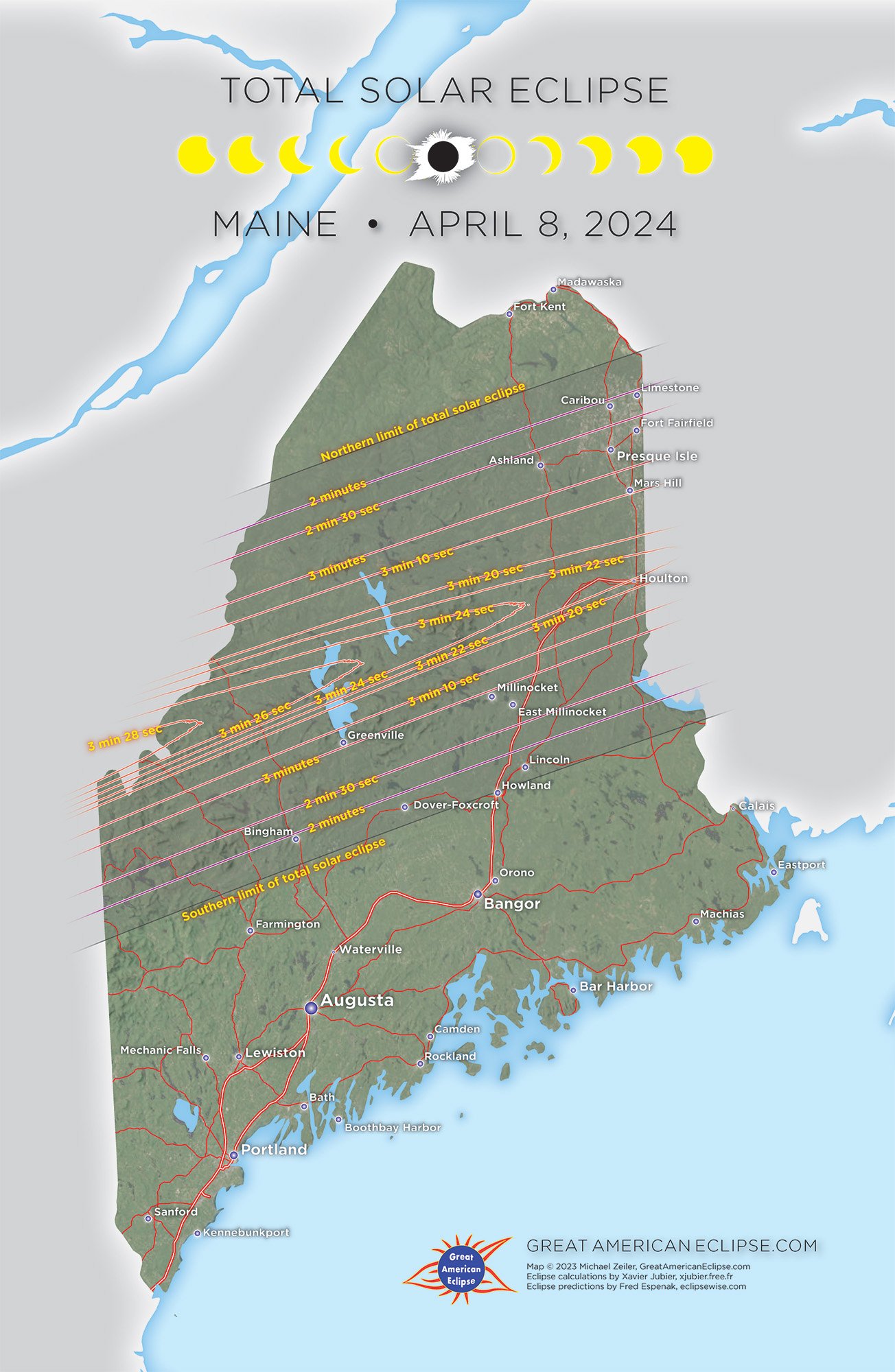
How long is totality in my area and how does it vary across the path? The longest duration of totality will be in the center of the path.
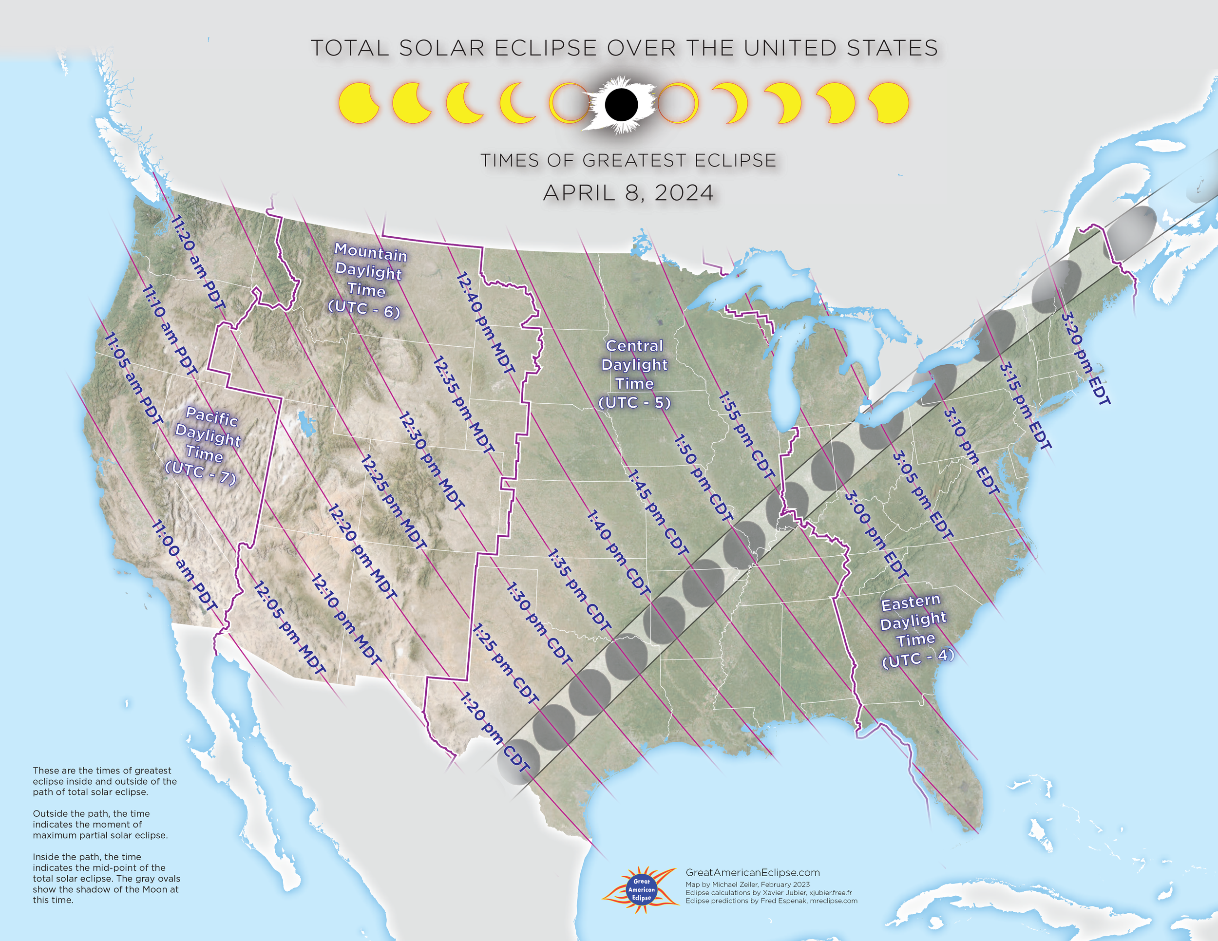
What time is maximum solar eclipse, both inside and outside of the path? And inside the path of totality, what time is the mid-point of total solar eclipse?
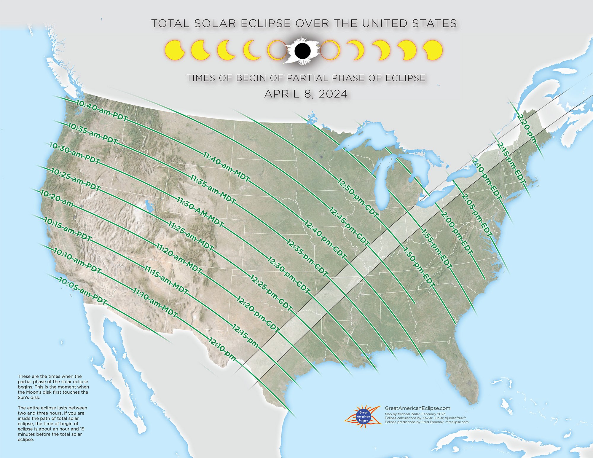
What time is the beginning of the partial phase of eclipse? The eclipse will last between two and three hours and the map shows when you can see the first nibble of the Moon on the Sun’s disk.
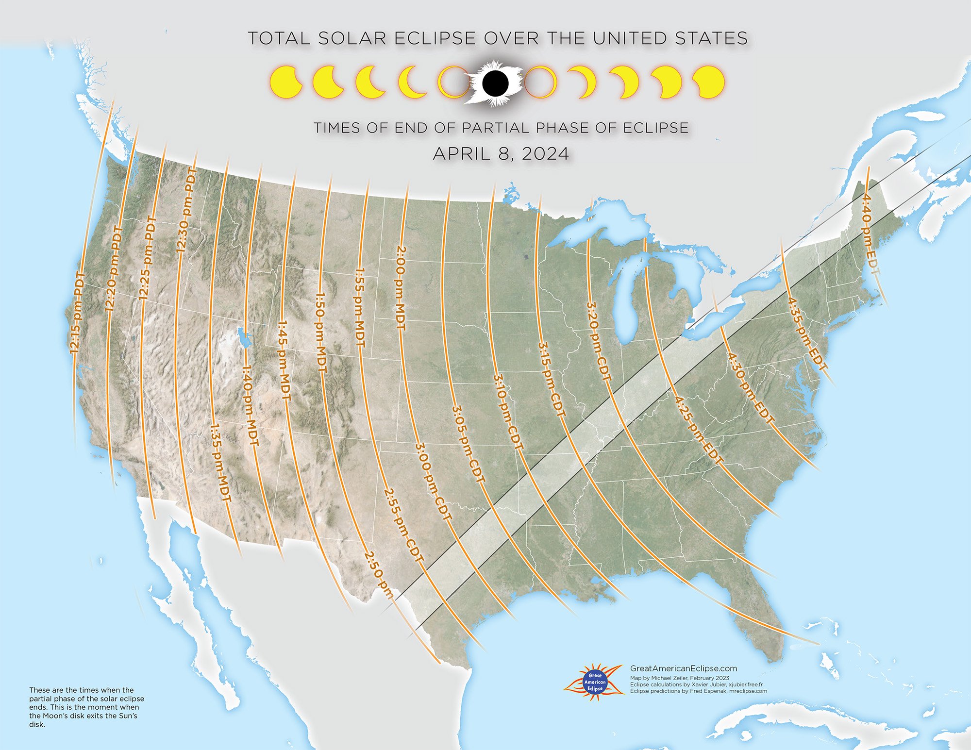
What time is the end of the partial phase of solar eclipse? Learn when the Moon at last departs Sun’s disk.

Our advice is to get your eclipse glasses viewers now, we are shipping most orders within a day. We offer several safe ISO-certified options for eclipse glasses viewers at greatamericaneclipse.com/eclipse-viewing, including ones that can be used with regular eyeglasses. Learn how to safely view solar eclipses at eclipse.aas.org/eye-safety/.
The Moon’s shadow
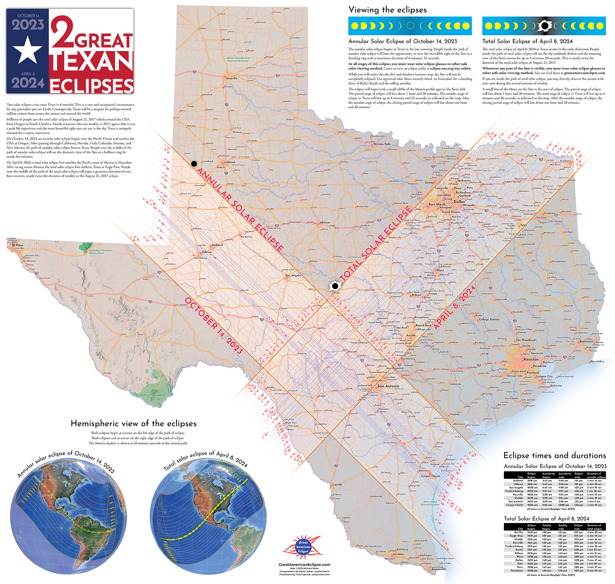
Watch the Moon’s shadow race across the United States. The dark oval is the Moon’s inner shadow - called the umbra - where the Sun is completely eclipsed by the Moon. Totality begins in the United States at Eagle Pass, Texas at 1:27 pm CDT with a maximum duration of 4 minutes and 27 seconds and a shadow velocity of 1587 miles per hour. Totality ends in the United States at Houlton, Maine with a maximum duration of 3 minutes and 18 seconds and a shadow velocity of 3176 miles per hour. The total time that totality occurs in the United States is 1 hour and 8 minutes.
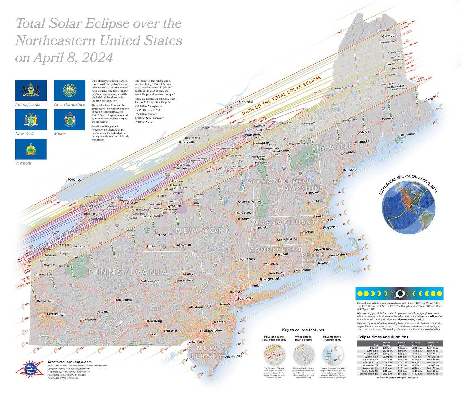
The states that are touched by the path of Total Solar Eclipse
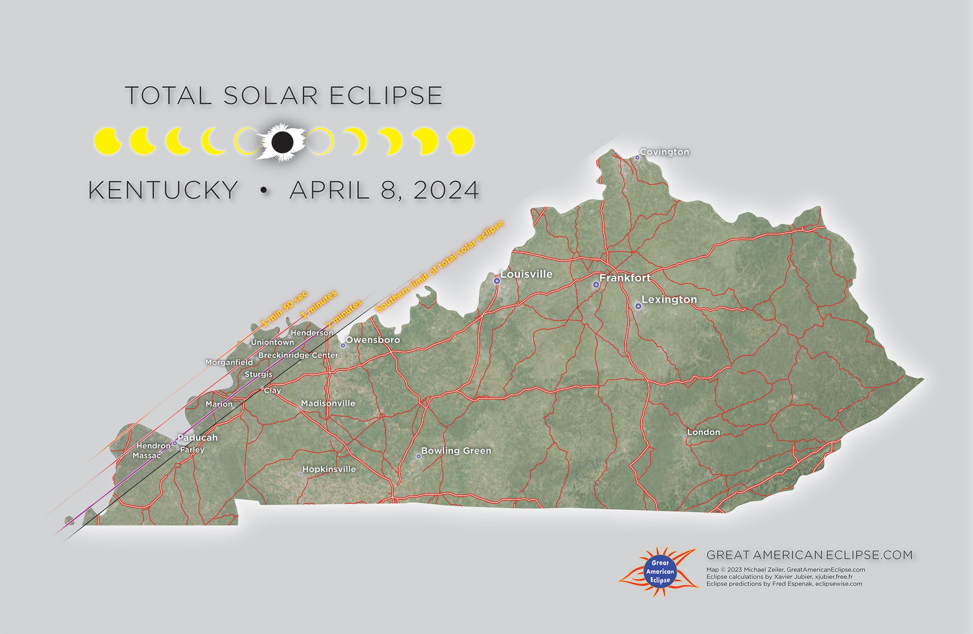
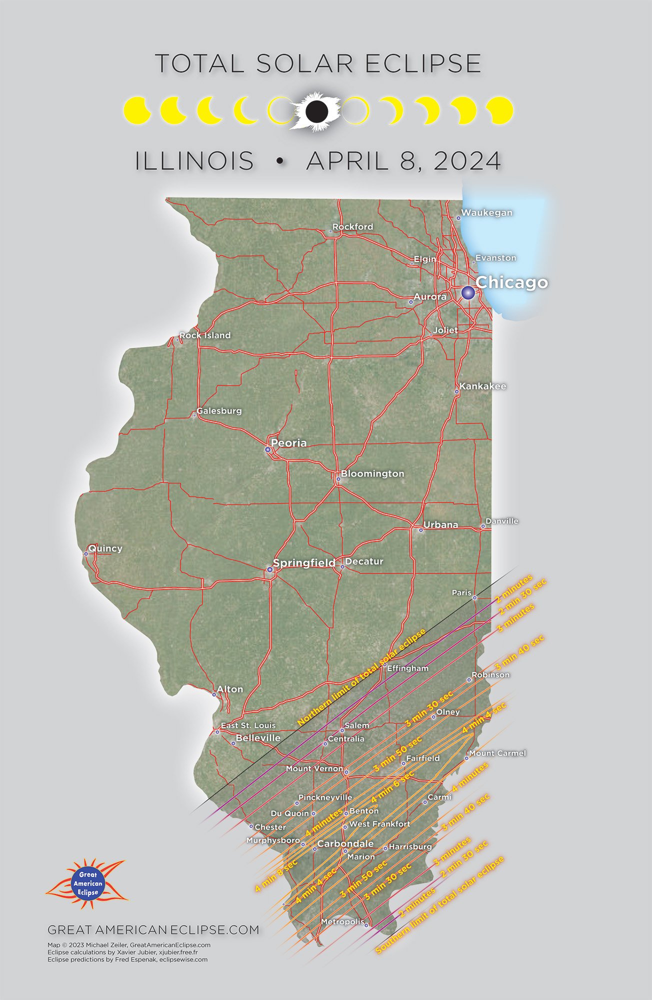
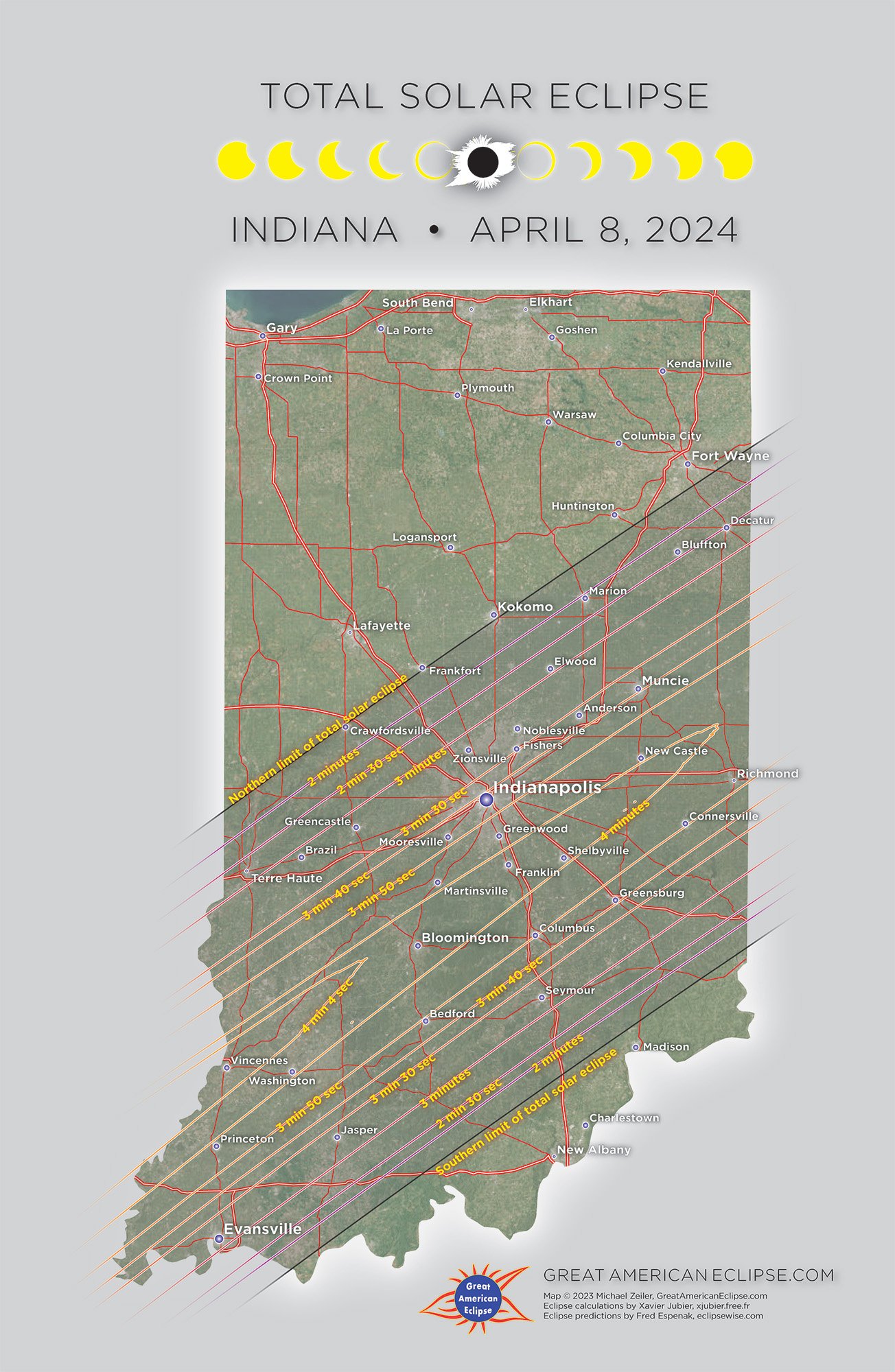
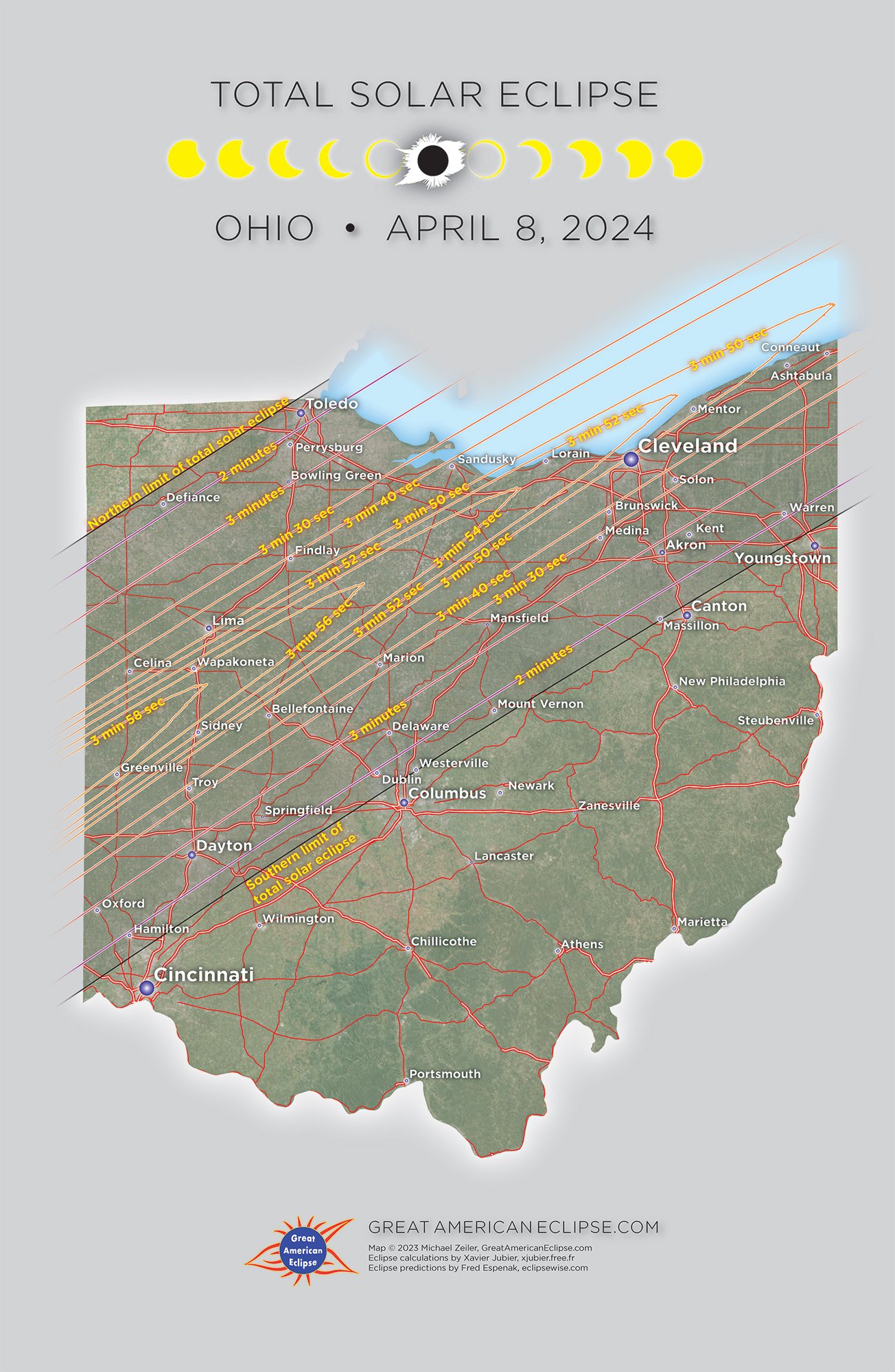
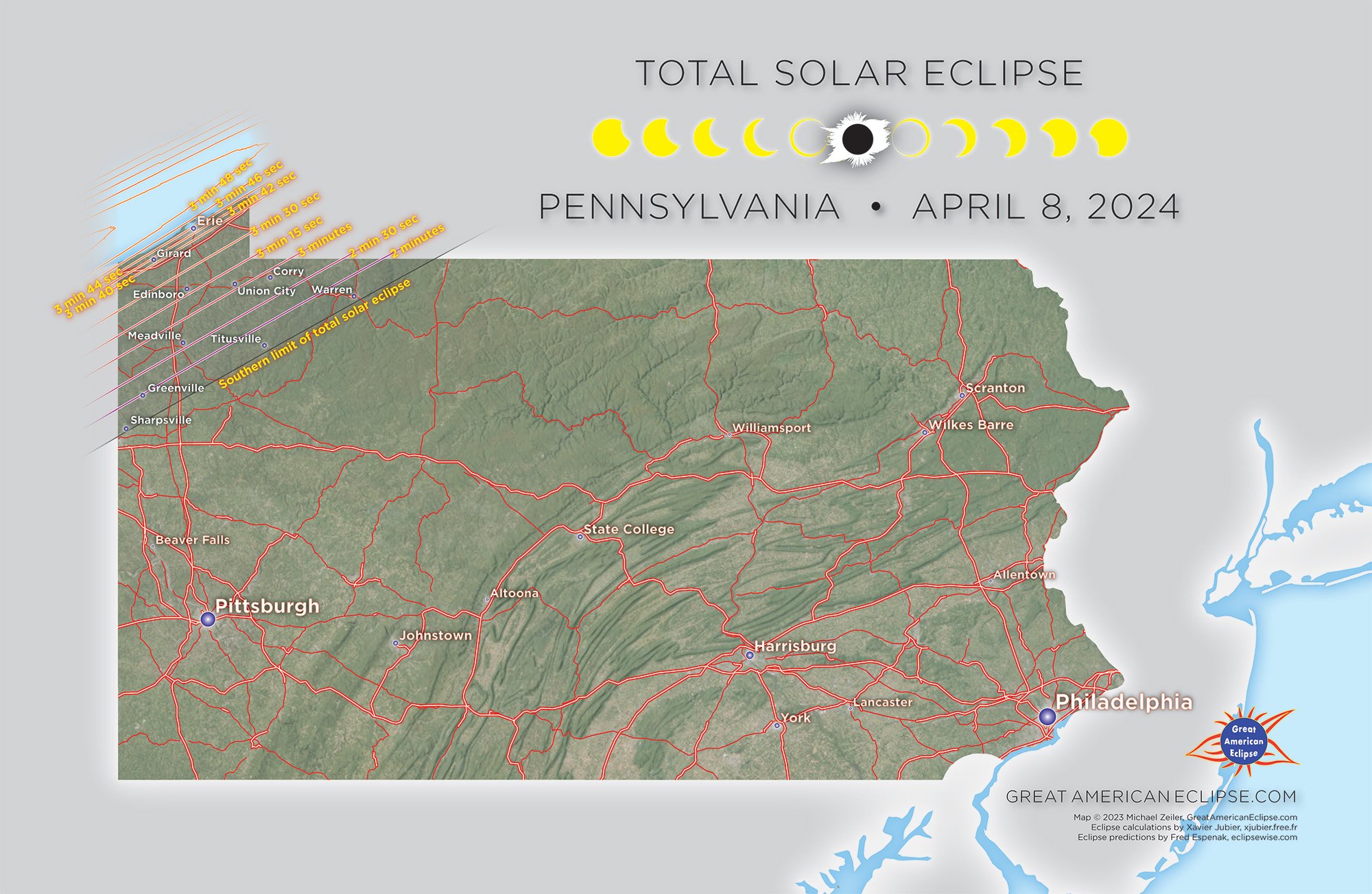
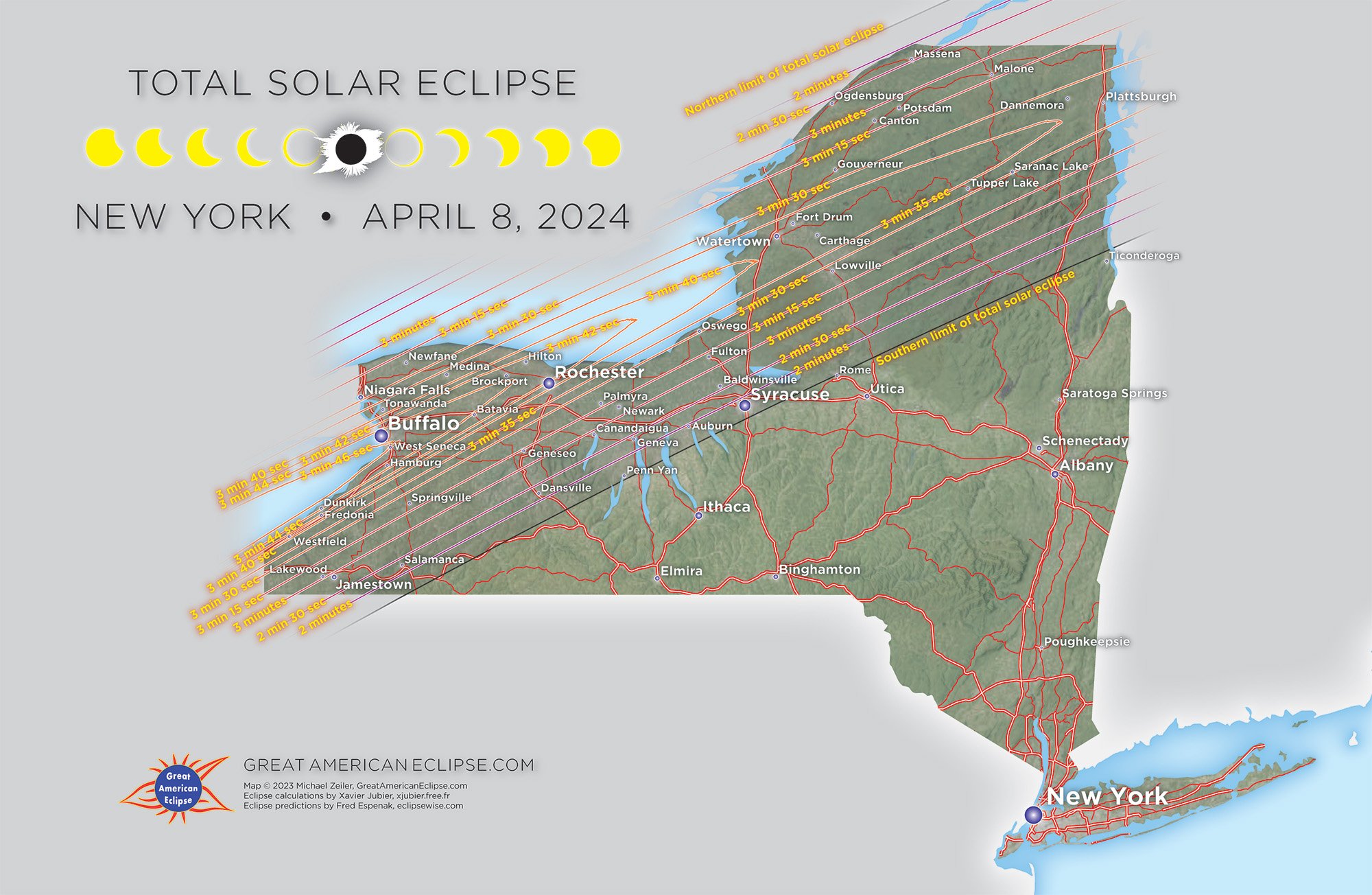
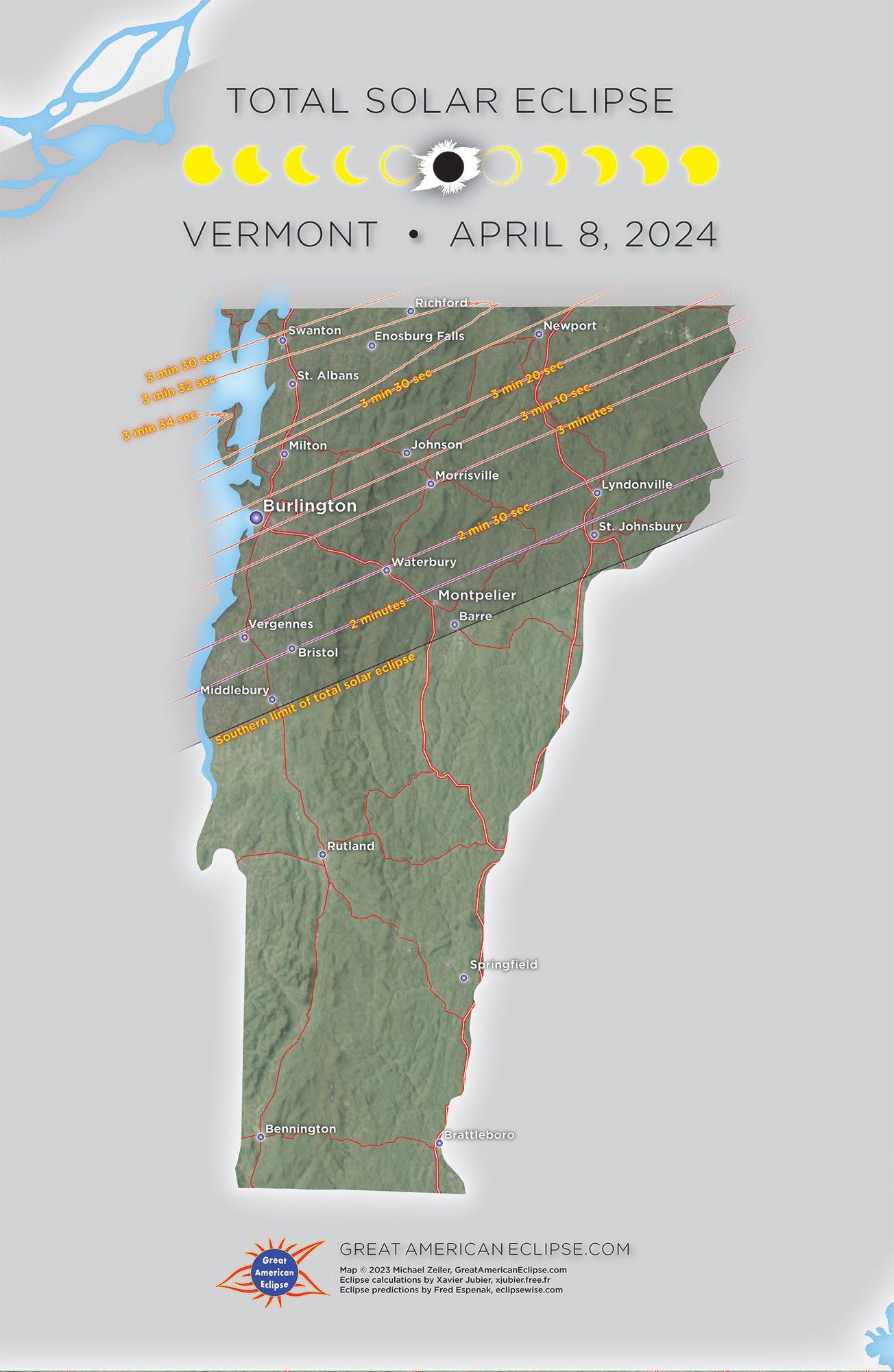
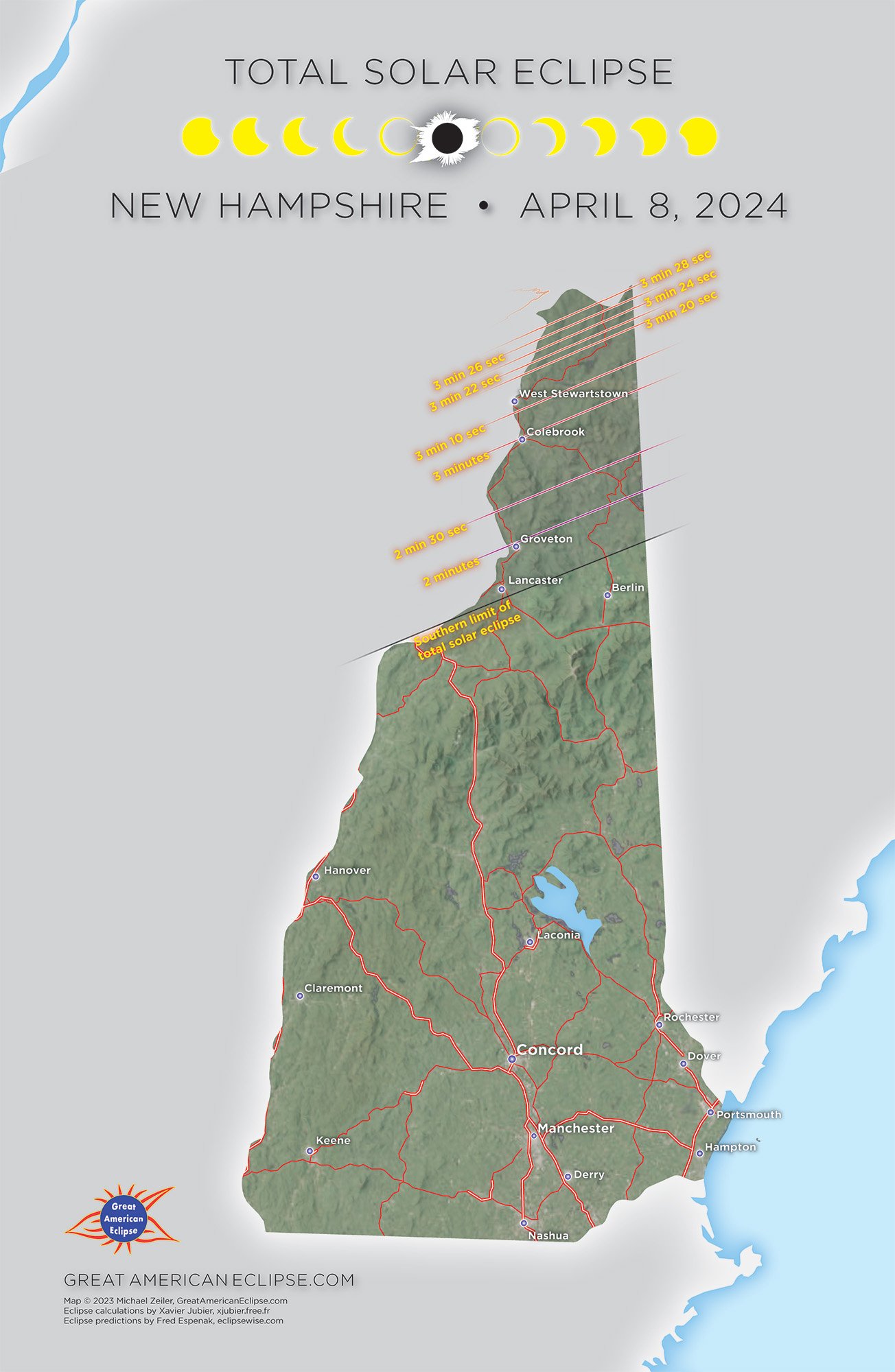
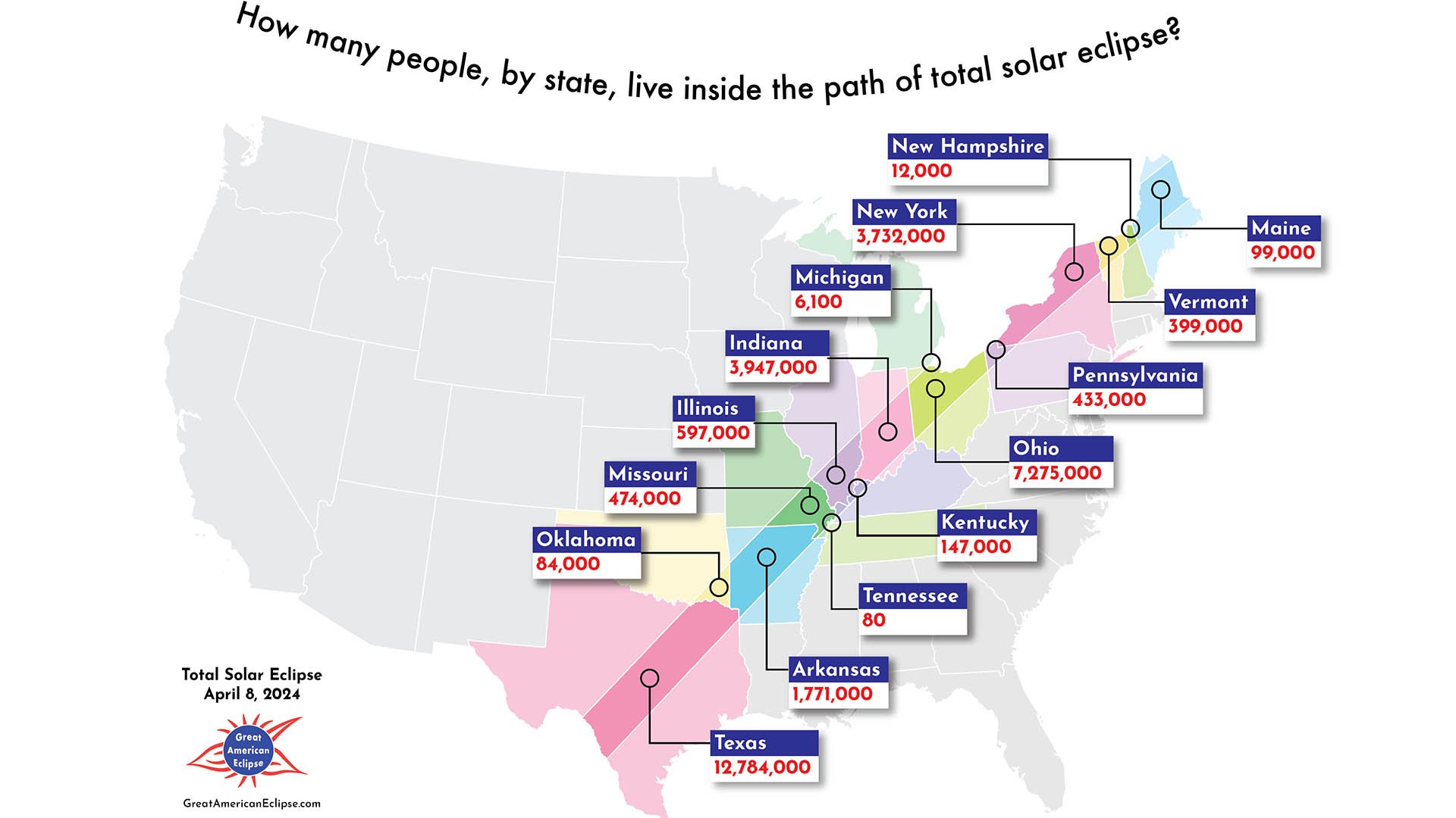
The 15 lucky states that will be visited by the Moon’s shadow during the total solar eclipse are Texas, Arkansas, Oklahoma, Missouri, Tennessee, Illinois, Kentucky, Indiana, Ohio, Michigan, Pennsylvania, New York, Vermont, New Hampshire, and Maine. We’ve created the maps below for each of these states. Tennessee and Michigan are omitted because the Moon’s shadow only touches a small corner of these two states.
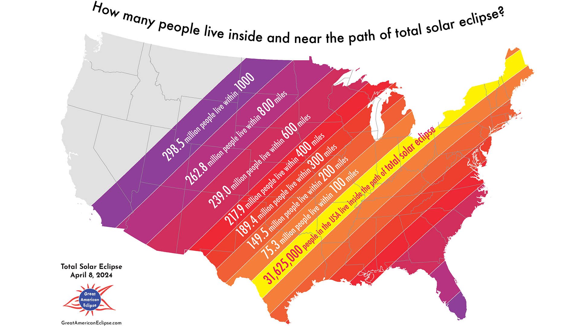
The Impact of the Eclipse
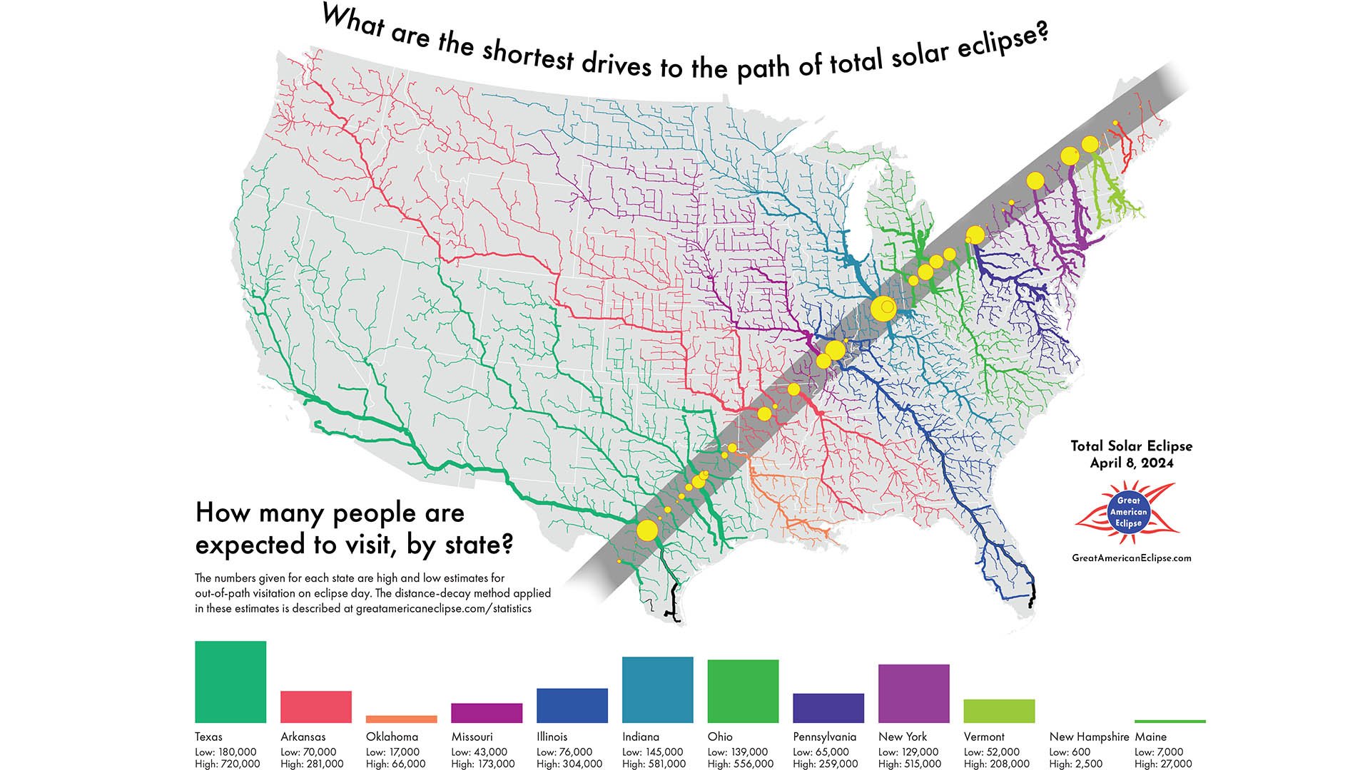
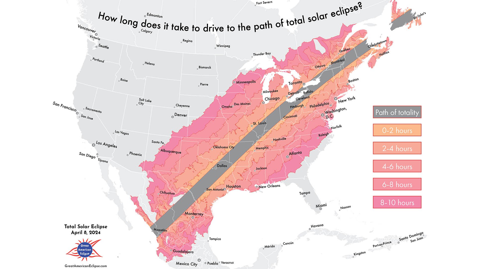
How big will the impact of eclipse visitation be to the communities inside the path of totality? 31 million people already live inside the path of totality. These maps summarize the potential tourism from neighboring states, showing travel distance throughout the nation.
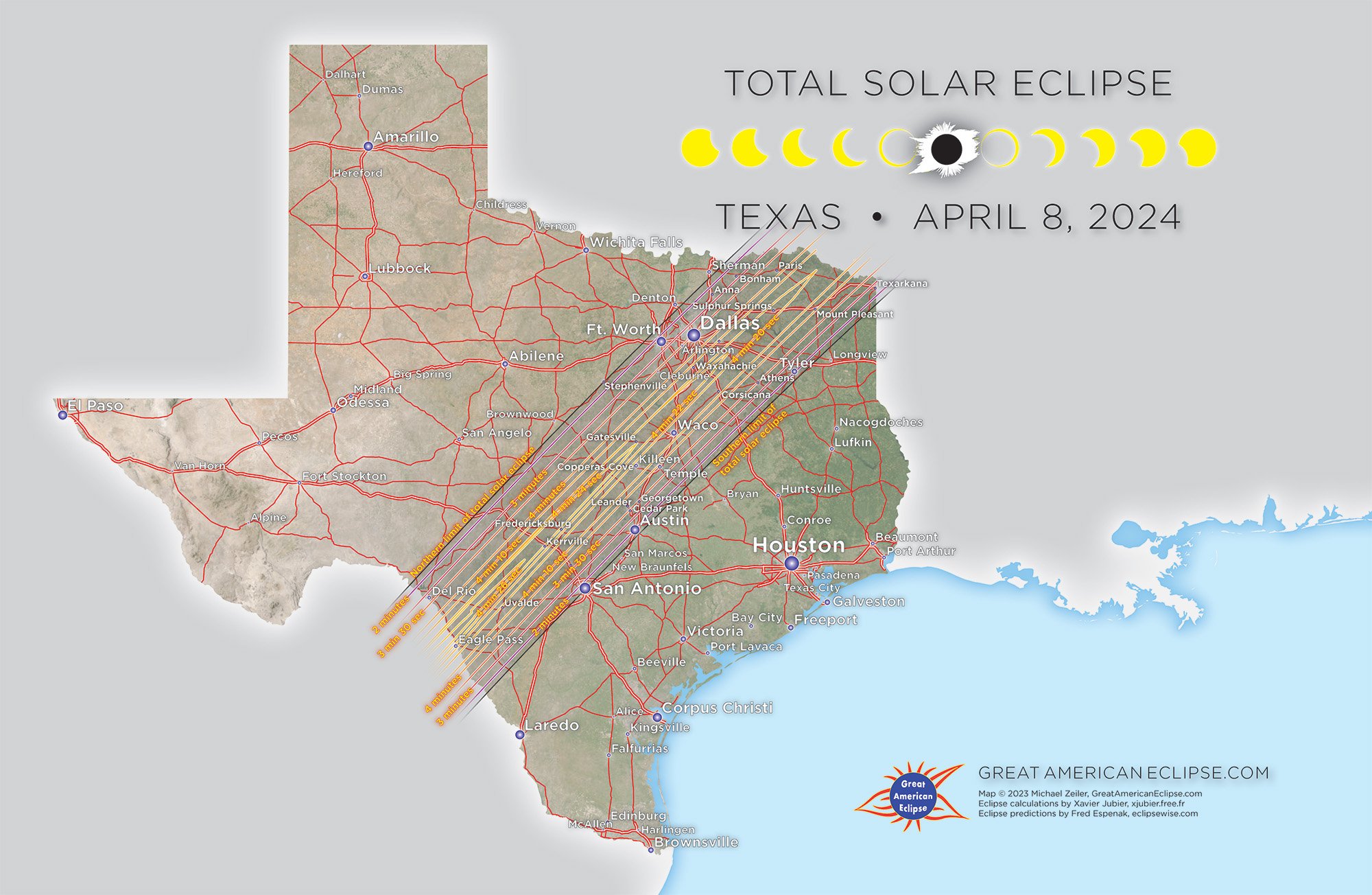
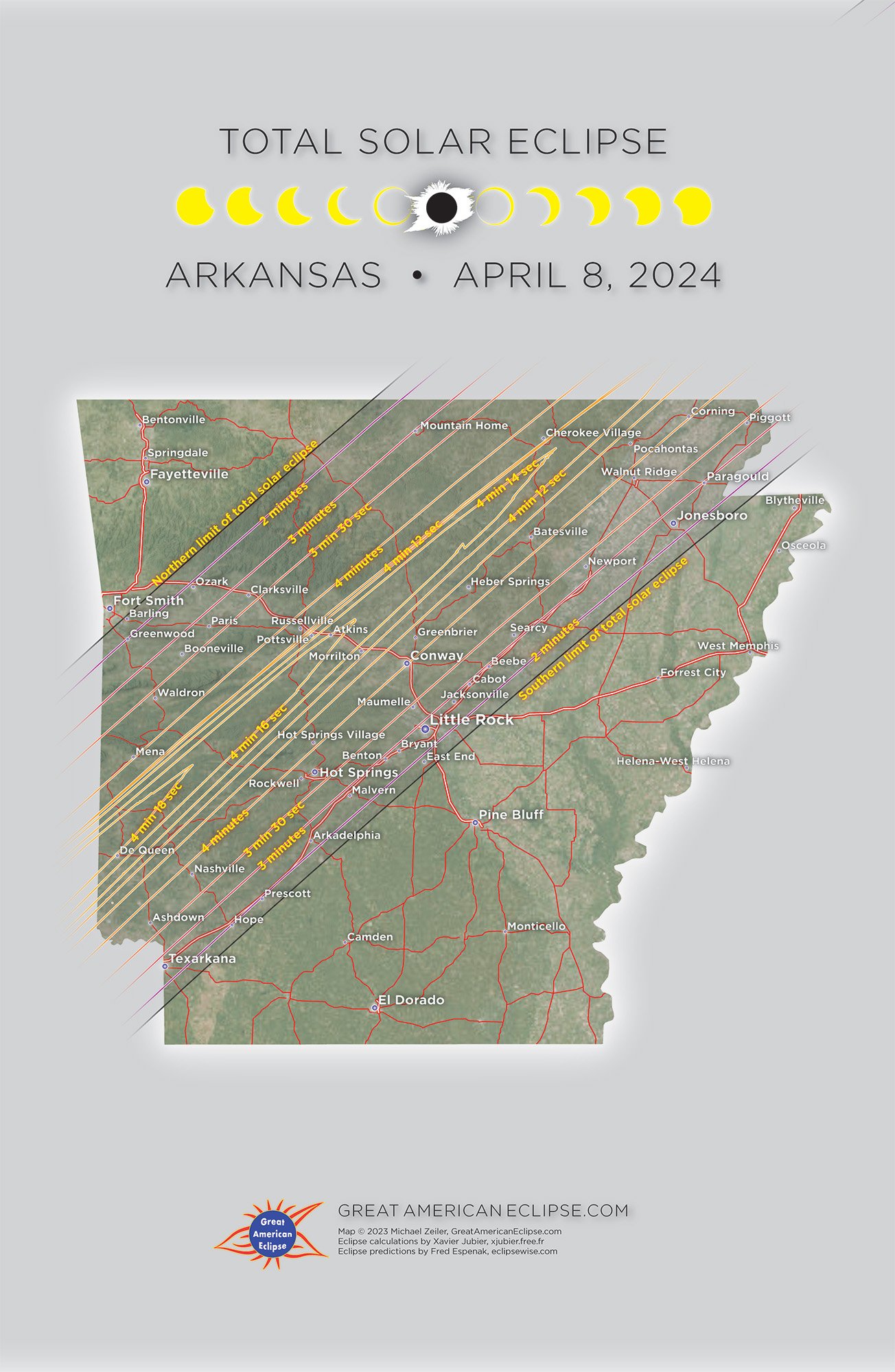
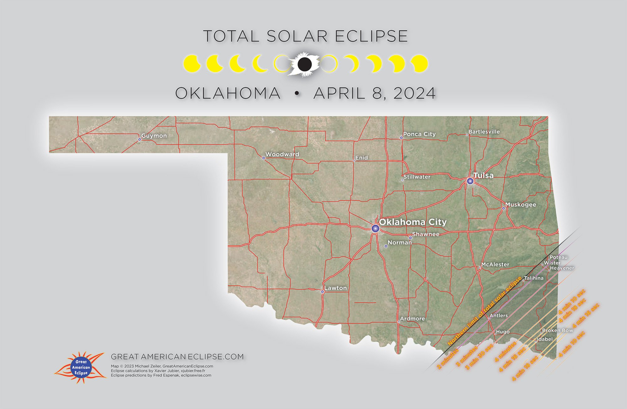
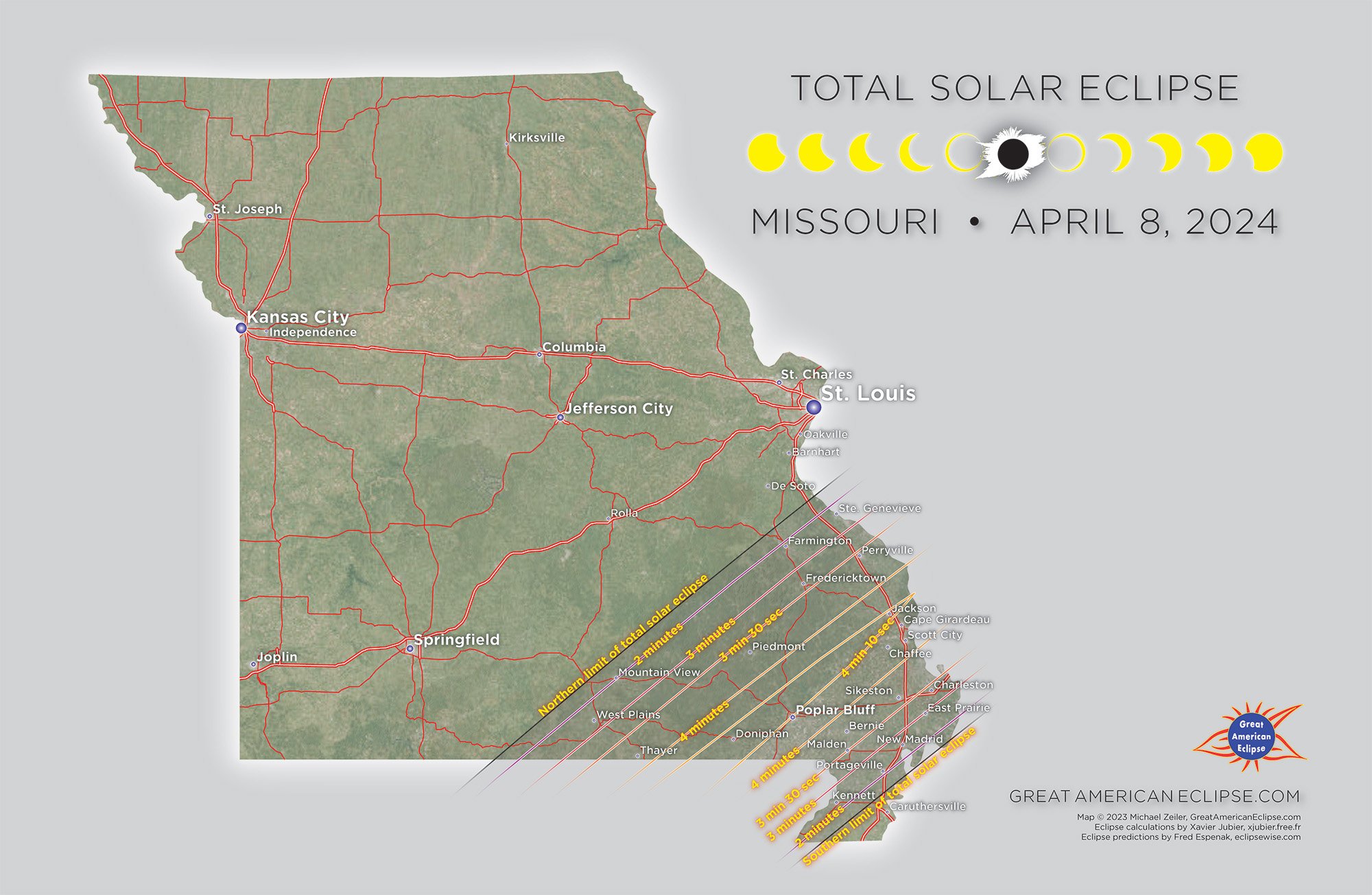
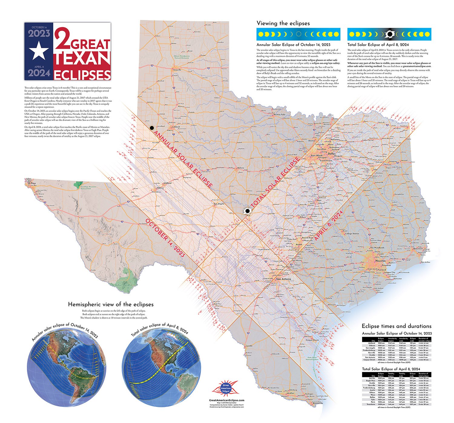
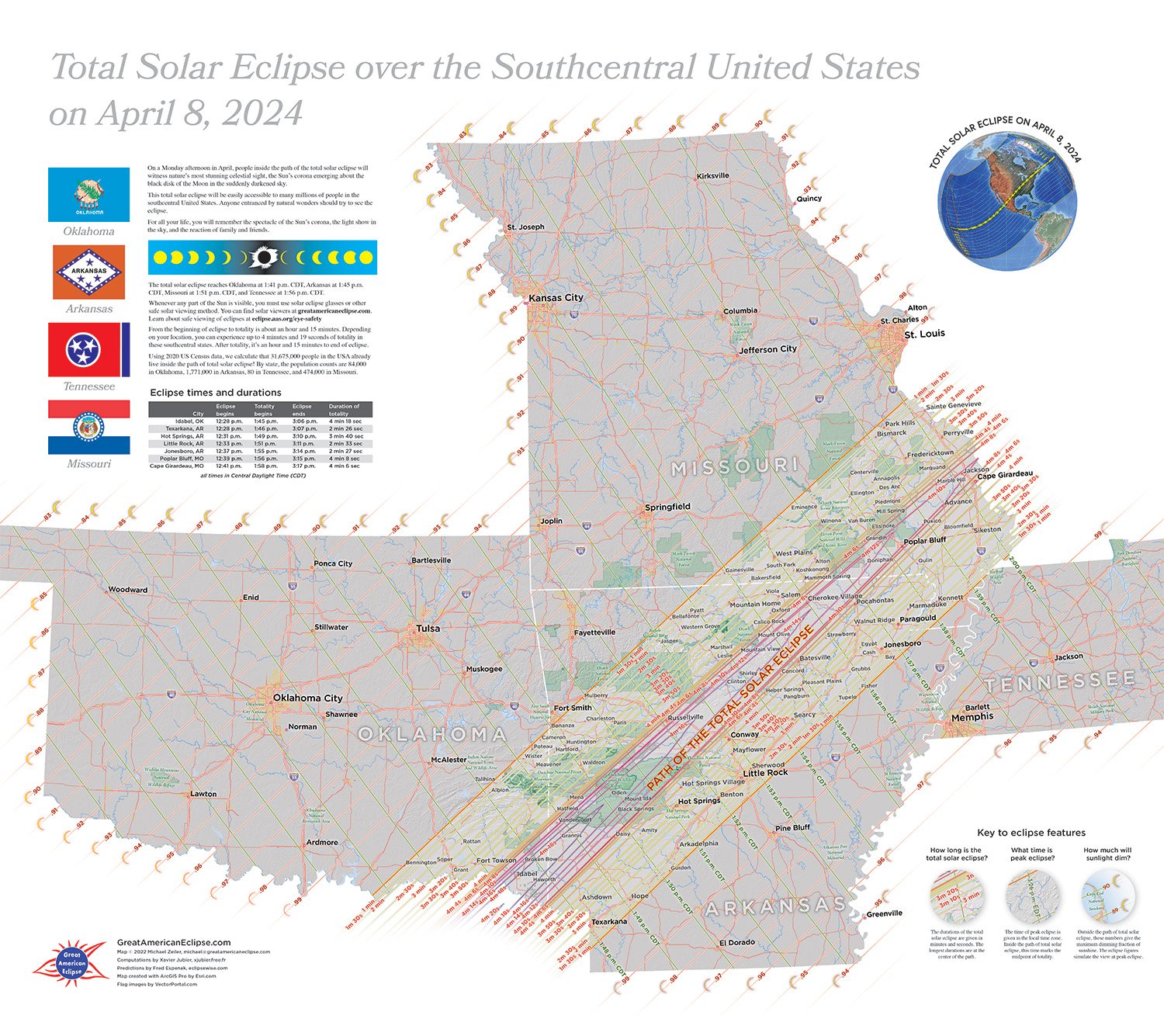
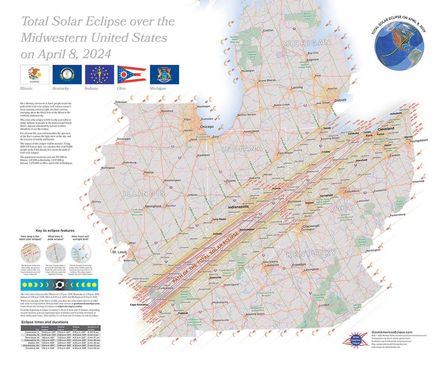
Poster Maps of the Total Solar Eclipse over the United States
We offer these maps with greater detail on our online store. They are designed to help you find your optimal site for eclipse day. Our map are acclaimed for their artistry, accuracy, and utility. Click on each map for the store entry.
These online maps, and all the maps on this website, can be freely used for community outreach, social media, websites, print and broadcast media. Please provide credit and link to our website. Please contact us for commercial uses, our guidelines for use are here.